Moving to Southern California occupied my attention for the last month. Now that I'm back, here's a few Spring photos. I don't know what the Sierra looks like now, aside from the Mineral King Webcams, but in May the snow remained thick. One could get up to Tokopah Falls by walking around snow piles, hurtling fallen trees, and praying that the ice over creeks would hold their weight.
Bridge across from Lodgepole Parking Area:

From what I've heard, the rivers are ridiculously swollen now. The Sierra had about 4 times normal snowpack and it's finally summer...

Alta Peak, as seen from Moro Rock summit:
 Unfortunately, it was foggy on top of Moro that day. I waited over an hour for some clearing, but didn't get much more.
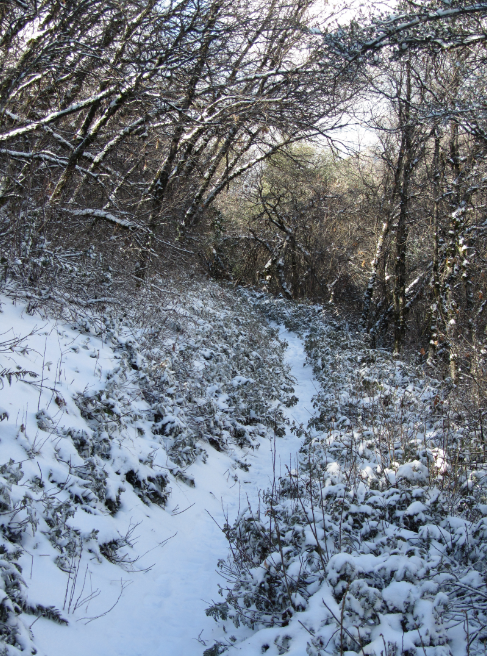
Up the trail from Lodgepole, it became sunny for short intervals. Air temperature was lower than during my snow shoeing trip in February.


Tokopah Falls was visible toward the end of this walk. Icy rocks prevented me from climbing up there, but it was still inspiring.

 Hopefully I can get into Mineral King this summer. I got too close to Sawtooth Peak before that storm appeared. If the snow ever does melt, I'll certainly head up again.


 Giant Forest Musuem is closed:


 General's Highway, after being plowed out yet again. Last I read, this was the Sierra Nevada's 2nd or 3rd snowiest winter on record.
 The high that day was 42 degrees, but you wouldn't know from looking at this creek:
 Snow crushes the bridge outside of Lodgepole parking lot:
  The railing is about three and a half feet high. I walked over it anyway. There was no actual danger of falling into the water, because the snow engulfed my legs before I could begin to slip anywhere.
  Moro Rock:


 It was 'partially cloudly' that day:


 Lower Monarch Lake, seen from the climb up Sawtooth Pass:


